
Lakefront & Shoreline Clearing in North Carolina – The Property Line Is the Whole Job
On a lake lot your deed stops before the water does. We find the boundary first, clear your side with the mulcher, and tell you exactly what the utility, the Corps or the watershed rule allows on theirs.
Why Choose Us
Lakefront & Shoreline Clearing: Before & After
Real results from recent projects across Central North Carolina.
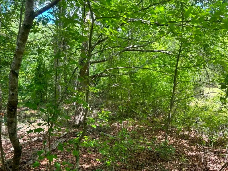
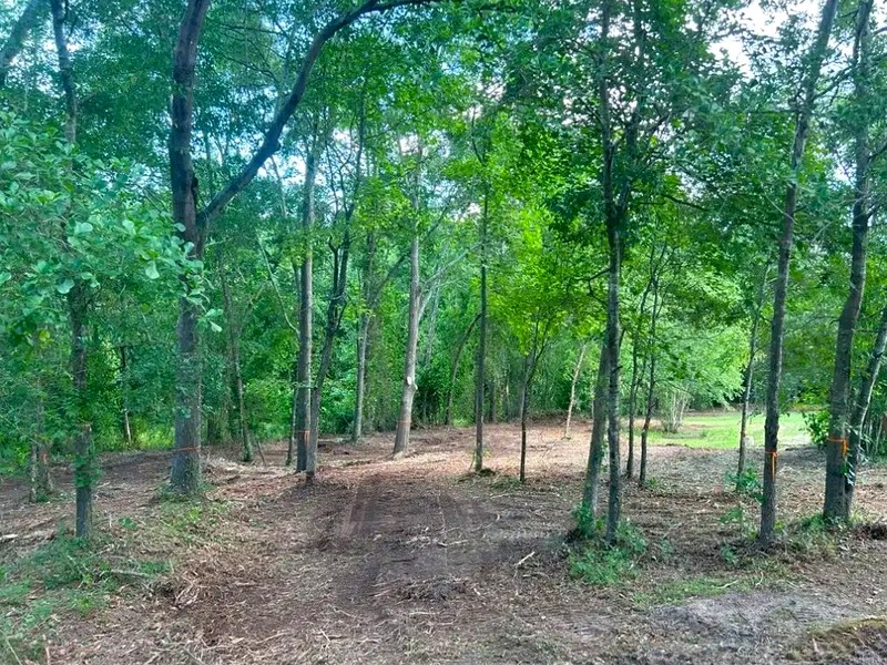
Illustrative example – mid-story growth removed, ground cover and canopy retained
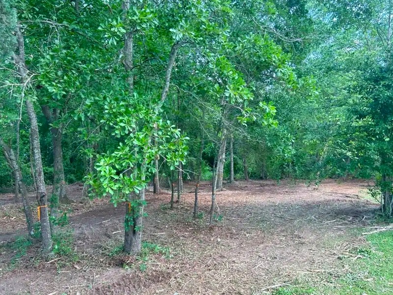
Illustrative example – understory and vines mulched in one pass, mulch left as erosion cover
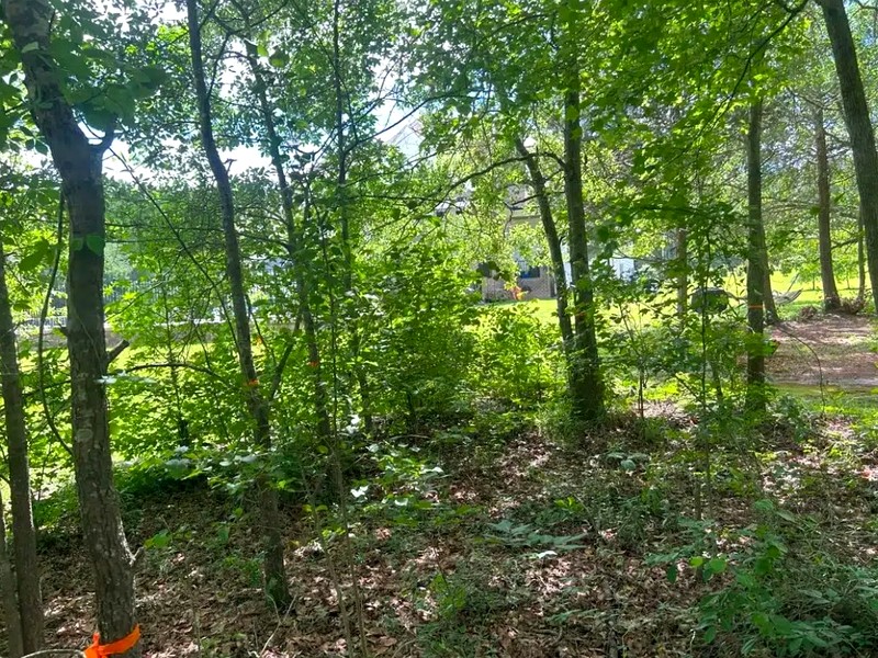
On a Lake Lot, Your Deed Stops Before the Water Does
Almost every lakefront owner in North Carolina owns less than they think. On Lake Gaston, Dominion Energy owns a strip of land running up from the maximum normal water level of 200 feet above sea level. On Kerr Lake, the US Army Corps of Engineers owns the equivalent strip. On Falls Lake and Jordan Lake, the rules come from watershed protection instead. In every case there is a line between the house and the water, and on the far side of it the county land disturbance permit that governs ordinary clearing decides nothing at all.
That is the job on a lake lot. Not the cutting, the line. We clear up to it with the mulcher, we tell you exactly what the authority on the other side allows, and we do not cross it without the permit in hand. Cut Brush handles lakefront and shoreline work on the Wake Forest and Creedmoor side of Falls Lake, the Pittsboro and Apex shores of Jordan Lake, the Harris Lake properties around Holly Springs, and north into the Roanoke River reservoirs at Lake Gaston and Kerr Lake.
Why the Wrong Cut Costs More Than the Job
Clearing the wrong side of a shoreline line is not a warning letter. On Lake Gaston, the minimum administrative fee for a Shoreline Management Plan violation is $1,000, and that is before damages, which Dominion assesses on the ornamental value or the timber value of what was removed, whichever is greater. Dominion can also withhold approval for structures on the affected land until it is satisfied the impact has been mitigated, which in practice means the dock permit stops moving.
On Kerr Lake the consequence is aimed somewhere more painful. The Corps documents encroachments and trespasses, and those records can be filed at the county courthouse against the property deed. In the Corps' own words, most lending institutions will not proceed with a loan while such a condition exists. An owner who cleared thirty feet of Corps shoreline for a view can find out about it years later, at closing, when the buyer's lender pulls the title. A citation on top of that carries a fine and can require an appearance in a United States Magistrate Court.
None of that is recoverable by re-planting. It is recoverable by not doing it, which is a planning problem before it is a cutting problem.
What Dominion Actually Allows on Lake Gaston
Lake Gaston's shoreline is sorted into four classes, and the class decides the work: General Development Areas, Limited Use Areas, Sensitive Areas, and Special Management Areas. The distinction is not visible from the water and it is not printed on your survey.
In a General Development Area, the permitted cut is a band between 2½ feet and 20 feet above the ground. Dominion calls it the Cleared Area. Ground cover and low shrubs stay, because they hold the bank and feed wildlife. The canopy stays. What comes out is the middle, which is exactly the layer that closes a view. Any clearing carries a standing requirement that tree density and canopy cover comparable to what was there before must be maintained.
In a Limited Use Area, trimming may be allowed inside a 100-foot-wide zone where Dominion's land is less than 150 feet deep, nothing may be trimmed within 6 feet of the water line, and no shrub or tree may be removed for looks at all. In a Sensitive Area, nothing is trimmed or removed for aesthetic purposes, full stop. Underbrush clearing is a General Development Area activity only, it needs approval before anything is cut, and it is prohibited outright in Special Management Areas.
Trees are their own category. Nowhere on Dominion's property may a tree be removed without Dominion's consent, and consent is generally given only where the tree is dead, damaged, diseased, or a genuine safety or property hazard. If a permitted access path has to take out a tree more than 6 inches in diameter measured 5 feet up from the base, the replacement rate is three 15-gallon trees from Dominion's approved list for each one removed.
The Part Most Contractors Get Wrong: the Machine
This is where a forestry mulching company has to be honest about its own equipment. On Dominion's property, heavy equipment is strongly discouraged. It is considered only where safety is the issue, and it will not be considered at all in a Sensitive or Limited Use Area. Where tracked equipment is approved, matting has to be laid anywhere the tracks will run, access is through a single point inside a 12-foot construction opening, and you owe Dominion a drawing showing where the matting goes.
The default tools on that strip are chain saws and brush saws. The natural leaf bed may not be disturbed, debris may not be burned there, and no herbicide may be applied. Anything other than hand-held tools needs a Dominion representative to sign off first.
So the honest shape of a lake job is two jobs. Above the line, on land you actually own, the forestry mulcher is the right machine and none of those constraints apply: we run it through the understory, the scrub, the seedling pines and the invasive vines in a single pass and leave the mulch where it falls. Below the line, the work is hand tools, flagged in advance with high-visibility surveyor's tape, inspected and photographed by the authority before anything is cut. A contractor who quotes you one price to "clear down to the water" has not read either rulebook.
Where the Line Is, and How to Find It for Free
Most owners never locate their own boundary. Two things help. Lake Gaston's maximum normal water level is a fixed elevation of 200 feet above mean sea level, with the water normally moving between 199.0 and 200.0, and up to 201.0 between 1 March and 15 June, so a low-water week in late winter shows you far more than a June walk does.
On Kerr Lake the Corps will simply come and show you. The Corps runs a boundary survey and marking programme, and an adjacent owner can contact the Visitor Assistance Center and ask to have the property line identified on site. A Shoreline Ranger will walk it with you. The number is (434) 738-6143, the office is at 1930 Mays Chapel Rd in Boydton, and the Corps says plainly that these meetings exist partly to stop owners making a costly mistake. Almost nobody knows to ask.
Who This Service Is For
- Second-home and absentee lake owners.The lot has closed in over five or ten seasons of not being there. You want the water back in view from the deck and you do not want a letter from a utility.
- Buyers in the first year.You have just bought on the water, the survey says one thing and the shoreline says another, and nobody has explained which strip is yours.
- Sellers and their agents.A lakefront listing that does not show the lake is a price problem. Clearing the owner's side legally, before photos, is usually enough.
- Falls Lake and Jordan Lake property in the Triangle.Different authority, same structure: a protected strip, a buffer rule, and a view that has closed in. See our Falls Lake watershed guide and Jordan Lake watershed guide.
- Owners who have already been told no.A refused request is often a request for the wrong work in the wrong class, not a closed door.
Requirements vary by parcel, scope and jurisdiction. Cut Brush can flag the common considerations and help you identify the right office, and the governing authority or an appropriately qualified professional makes the final determination. Call 919-525-3950 or request a free quote and we will tell you what we think is cuttable before you pay anyone anything.
How Lakefront & Shoreline Clearing Works
We keep the process simple so you can focus on enjoying your land.
Find the Line Before Pricing the Cut
We establish where your ownership ends and the utility's, the Corps' or the watershed buffer begins, and which shoreline class you are in. On Kerr Lake that can mean asking a Shoreline Ranger to mark it. Nothing gets quoted until this is settled.
Split the Job at the Boundary
You get one scope with two halves: mulcher work above the line where it is unrestricted, and hand-tool work below it if and only if the class allows it and the permit is granted. Both halves priced separately so you can decline either.
Flag, Approve, Then Cut
Anything on the authority's side gets flagged with high-visibility tape and left standing until the inspection is done. We cut the owner's side while that runs, so the job is not held up waiting on a permit that may take weeks.
Why Property Owners Choose Cut Brush
Professional equipment, local expertise, and results you can walk on the same day.
The View Back, Without the Violation
The layer that closes a lake view is the middle one, and on a General Development shoreline that band between two and a half and twenty feet is the part you are actually allowed to take. Done inside the rule, the view opens and the bank stays held.
No Cloud on Your Deed
Corps encroachments get recorded against the property at the county courthouse, and lenders stop there. Clearing inside the boundary keeps a future closing clean. This is the reason to hire someone who reads the plan rather than someone with a bigger machine.
Honest About Where the Mulcher Cannot Go
Heavy equipment is strongly discouraged on Dominion property and ruled out entirely in Sensitive and Limited Use areas. We say that up front instead of quoting a single price to clear to the water and sorting it out later.
Ground Cover and Canopy Left Intact
Low shrubs hold a lake bank and the canopy is the reason the lot is worth what it is worth. Both are required to stay under Dominion's rules and both should stay anyway. The mulcher's tight turning radius is what makes working around them possible.
Low Water Is the Right Time to Look
Lake Gaston normally sits between 199 and 200 feet above sea level and can run to 201 from the first of March to mid June. A late-winter walk at low water shows you a boundary that a summer walk hides.
Nothing Burned, Nothing Sprayed, Nothing Hauled
Debris burning and herbicide are both prohibited on Dominion's strip, and the leaf bed may not be disturbed. Above the line the mulch layer stays on site as erosion cover, so there is no debris pile and no truck convoy on a lake road.
Get a Free Lakefront & Shoreline Clearing Quote
Tell us about your project and get a custom quote – no obligation, no pressure. Curious how pricing works? See our land clearing pricing guide.
Request a Free QuoteRelated Services
Need something beyond lakefront & shoreline clearing? We handle a full range of land clearing work across Central North Carolina.

Selective View Clearing
Mark the trees to keep, mulch the rest. The method above the boundary line.

Forestry Mulching
Single-pass clearing that leaves the mulch on site as erosion cover.

Invasive Species Removal
Vines off the hardwoods you are required to keep standing.

Brush Clearing
Understory and scrub on the owner's side of the line.

Trail Cutting
Walking access down toward the water on your own ground.
Lakefront & Shoreline Clearing Across Central North Carolina
We provide lakefront & shoreline clearing services in these towns and surrounding areas.
Lakefront & Shoreline Clearing FAQ
Ready to Take Back Your Land?
Get a free, no-obligation quote for lakefront & shoreline clearing in Central North Carolina.
Get Your Free Lakefront & Shoreline Clearing QuoteOr call us directly: (919) 525-3950